Saurpani is reported to have about 1756 households and a population of about 6000 people. Saurpani is a place full of religious and natural beauty. There are many religious, historical and tourist areas here. Saurpani is home for many famous ethnic groups in Nepal. Some of the ethnic groups found here are Brahmin, Chhetri, Gurung, Magar, Dalit, Newar, Tamang. There are many sub castes amid one ethnic group for example Brahmins have subcastes of Paneru, Dhakal, Neupane, Devkota, Koirala and so on.
Many festivals are celebrated in Saurpani. The major festival of the village is Dashain and Tihar and other festivals especially belong to various ethnic groups. Gurungs celebrate Sokhi, lhosar, Magars ce;berate Maghi and most people celebrate Chandi Purnima on the Birthday of Buddha. People participate in each other’s festivals and show an example of ethnic tolerance.
Saurpani used to be a village of vitality. People sang and danced and had fun with Ghatu, Rodhi, Kauda and Maruni dances. But now a days it has kind of lost its charm as a significant population, especially the young people have been either displaced or gone to the cities and even foreign countries looking for better opportunities.
When we talk about saurpani it is large village that used be called Saurpani Village Panchayat during Panchayat regime and became Saurpani Village Development Committee after the multi-party system prevailed. After promulgation of the new constitution, it was merged into Barpak Sulikot Rural Municipality of Gaupalika. When we talk about Saurpani, we are referring to the old Saurpani VDC that extended from Daraudi in the west and Hundi Khola in the east. It bordered Taku in the southern border and Barpak in the Northern Border. This area is also known as Ghunchok.
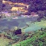
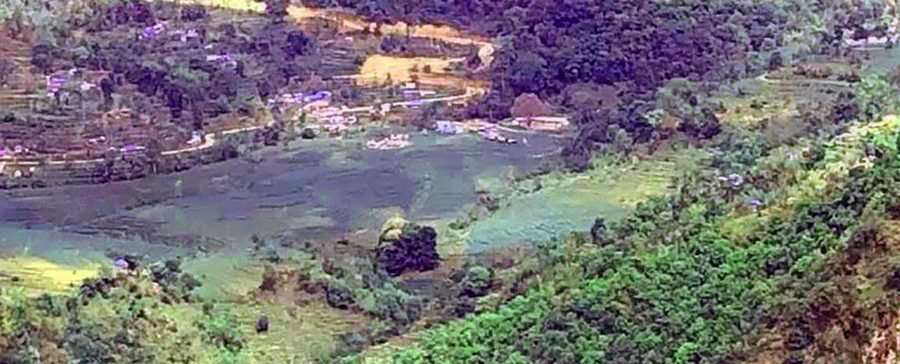
There are beautiful sub villages in this large village having over 6000 people. Some of the villages in the western side of the village are Ghunchoktar, Kalibote, Tarigaon, Bhuwane, Archale, Simthali, Gauthali, Ghunchok, Jedada, gairi gau and Saurpani. The eastern side has villages called Pokhari Gau, Gyaji, arubote etc. It extends all way to rancho Kenwara.
Saurpani used to be a village of vitality. People sang and danced and had fun with Ghatu, Rodhi, Kauda and Maruni dances. But now a days it has kind of lost its charm as a significant population, especially the young people has been either displaced or gone to the cities and even foreign countries looking for better opportunities.The earthquake of 2072 destroyed almost the entire villages. After the 12th century, Ghale kings ruled in Saurpani and this rule ended after the 12th century.Saurapani is now in ward no. 4 of Barpak Sulikot rural municipality in Gorkha historically significant kingdom previously, now a district amid 11 districts in newly structure Gandaki province.
Barpak Sulikot Rural Municipality has its importance in history. It is believed that a King of Sulikot used to rule this area and later it was under Ajirkot of Ghale Kings. World famous VC winner Gaje Ghale was born in Barpak.
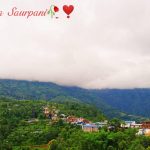
The Barpak Sulikot Rural Municipality Saurpani consists of several previous vdc including Saurpani that falls into ward No. 4 now. Saurpani is located at 59.8 KM from the district headquarters and in the elevation of 1439 meters to 3200 meters above sea level. Saurpani (Solar Water literally) is reported to have about 1756 households and a population of about 6000 people Saurpani is a place full of religious and natural beauty. There are many religious, historical and tourist areas here.
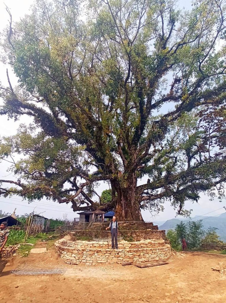
There is a story about how the name of Saurapani came to be. According to the elders there was a well under the Saur (a medicinal herb) tree. The residents used get the water from that well. That’s why people started calling that area Saurapani. Some people give the logic that since literally it is Solar Water it is village of SUN and water, arguing Saurpani is rich for water and sunshine. Whatever the reason may be, people living in Saurpani village are proud of this name and their beloved village. Saurpani is a village united in diversity located in the northern direction of ward number ‘4’ of Sulikot Rural Municipality, Barpak Zone, Gorkha District, Gandaki. Saurpani is located at 1439 meters to 3200 meters above sea level.
Vehicles also come from Gorkha and Kathmandu every day so that the residents of Saurpani can get around easily. Saurpani is located at a distance of about 60 km from Gorkha and 6 km from Palungtar Airport.
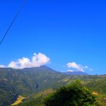
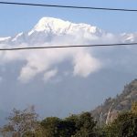
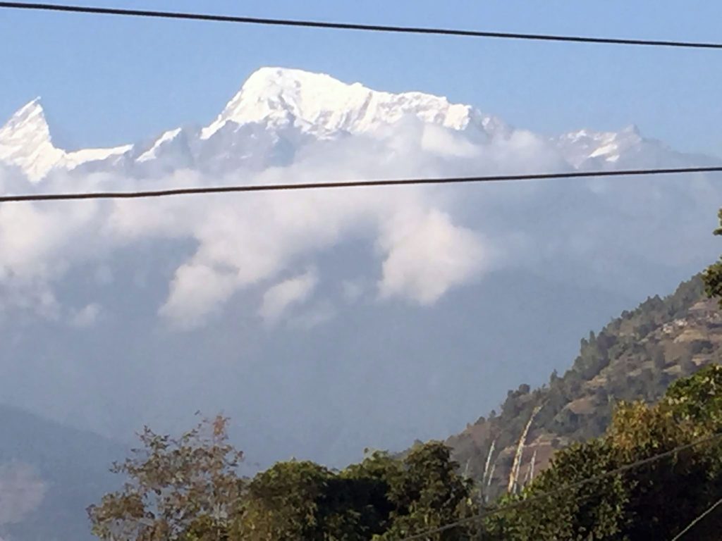
Although the transportation system in Saurpani is still in primitive stage, there are transportation services. Saurpani is with road connected through Darundi river located in Abukhareni, while another road can be reached through Bakot-Palkhu. Swara, Masel Pandrung-Takukot-Takumazh, Lakuribot. Electricity is supplied by the small Hydroelectricity project of Hundi Khola and in lagging behind the facilities of the central line.This beautiful village Saurpani is situated in the lap of Mount Manaslu and Baudha Himal. It has a rich cultural heritage with many ethnic groups with varied traditions and lifestyles. It had breathtaking natural beauty with hills, green fields, rivers, streams and waterfalls.